![]()
![]()
![]()
![]()
![]()
 The days of making numerous stops and asking for directions on a long journey whose route you are not familiar with soon drawing to a close. Soon you will be able to locate your home, school, hospital, office and the distance from where you are online, thanks to Google Maps. Under a Project with Uganda Bureau of Statistics (UBOS), Google is mapping the entire country, starting with 8,000schools. The project is intended to bring the country on online maps. The global search giant is targeting 30,000 places of interest such as banks and hospitals, but private businesses can also place their locations online, all for free and by themselves, according to Dorothy Ooko, Google's head of communication and public affairs for East and Southern Africa.
"It doesnot cost you anything to have your presence online. You can even map your home and share it with your friends who may use the maps to locate you if you are hosting a party," said Ooko. The initiative is great for small business to market themselves, especially among the growing online community. All one needs is a Google account, according to Ooko. There are currently about 600,000 Facebook accounts and thousands of Twitter accounts with the users spending a good amount of time online, which creates a good marketing space.
 MTN Uganda has launched an e-learning project for secondary schools in the western region. The project provides a platform for schools to share different information from the recommended school syllabus. It was launched on Friday at Bweranyangi Girls' Secondary School in Nyakabirizi division in Bushenyi district. Bweranyangi will act as a hub for schools in the western region. At least 51 secondary schools across the country are participating in the project.
Launching the project, Nicholas Mugisha, MTN's head of capital projects, said the e-learning project is a special initiative from MTN. "Information and communication technology is where the future lies. We should prepare students to face it," Mugisha added. He said the project will empower the learners through the Internet by availing them with relevant educational materials.
Read more: MTN Launches E-Learning Project in Bushenyi, Uganda
![]() You can now use your mobile phone to pay for your goods and services at specific points of sale, thanks to a new mobile payment solution that seeks to boost cashless transactions in the country.
You can now use your mobile phone to pay for your goods and services at specific points of sale, thanks to a new mobile payment solution that seeks to boost cashless transactions in the country.
Riding on the success of the mobile money platform, Imara Mobile has introduced a card-based mobile payment solution that enables mobile money users to pay for goods and services at supermarkets, restaurants, hospitals, fuel stations, among others.
Speaking in Kampala yesterday, the company’s general manager, Mr Albert Aguta, said although mobile money service providers have a provision where subscribers can pay for goods and services directly from their mobile money accounts, the culture is yet to pick up, with most people using the platform only for sending and receiving money.
“We want to promote a culture of cashless transactions in the country because of the convenience it comes with,” he said.
To transact using the Imara mobile wallet, a registered mobile money user needs to tap the Imara mobile Wallet Card on the point of sale to initiate the transaction.
Read more: New mobile payment solution to drive cashless transactions in Uganda
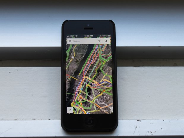
 Owners of smart phones in Kenya will now be able to enjoy an advanced version of Google Maps following the launch of the application's turn-by-turn navigation feature.
The turn-by-turn navigation feature, demonstrated to journalists by software technicians at Google Kenya, allows a user to move from one location to the next with accuracy as the information giant has integrated more data on roads within Nairobi and the country as a whole.
"We have 75 per ceof all roads in the country covered under the turn-by-turn navigation feature which allows ease of movement," said Mr Evans Arabu who is the Program Manager at Google Kenya.
Arabu added that with advancements in mapping, users of the application on either the android or iOS platform can assist in mapping the areas that are not yet covered through collaborative mapping.
"Through the map maker feature of Google Maps (mapmaker.google.com) users are able to plot more points on the existing maps," Arabu said adding that over the last three years there have been over 500,000 changes made by over 15,000 map makers.
 The Web giant is reportedly creating airborne wireless networks to bring Internet access to some of the world's hard-to-reach regions.
Google is reportedly working on creating wireless networks for more remote parts of the world, such as countries in sub-Saharan Africa and Southeast Asia, with sky-bound balloons and blimps.
Dubbed "high-altitude platforms," these mechanisms will reportedly be able to connect roughly a billion more people to the Internet worldwide, according to Wired. The blimps signals are said to be able to reach people in areas that are hundreds of square miles.
Last week, the Wall Street Journal reported that Google is going into the cellular business in Africa and Asia in an effort to connect more people to the Internet. Citing anonymous sources, the news source reported that the networks would be available outside of big cities, where service is spotty or not available.

Besides the Wi-Fi blimps, Google is reportedly also considering a satellite-based wireless system, along with testing other kinds of wireless frequencies, according to the Wall Street Journal. "There's not going to be one technology that will be the silver bullet," an anonymous source told the Journal.
It appears that Google has been working on high-altitude platforms for quite some time. In 2000, the company filed a patent application for a "High altitude platform control system," which involved creating an "aerospace vehicle" that could "improve the reliability of a communications system."
From CNET NEWS
Subcategories
TIPS & TRICKS ICT WORLD
- Codeigniter4: Howto fetch data by ID (button click) from database using JQuery Ajax
- Howto stop vulnerable Open Memcached on a Zimbra Server.
- Proxy Server not running on Zimbra Mail Server.
- Howto remove .php, .html extensions on a web page using .htaccess file
- How to Increase the Max Upload Size Limit
- Howto Create a Distribution List or Mailing List in Zimbra mail server
- Howto configure redirection/forward of specific user emails to another email address in Cpanel
- Restore WhatsApp Backup in Android and iPhone
- Howto backup your WhatsApp messages to your Google Drive.
- RESOLVED in JOOMLA3.9: “Error: Application Instantiation Error: Call to undefined method JApplicationHelper::getHash()”
- Howto configure Microsoft Outlook 2016
- How to embed a tweet in to any website (WordPress, Joomla and Drupal)